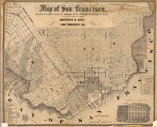
A closed grid plan by physical nature, San Francisco was imposed on a city of hills built on the end of a peninsula, the topographic features limiting opportunities for expansion. The city had a small area, but the grid pattern of the streets and the hills divided the cities into separate portions and valleys. In 1839, Jean-Jacques Vioget, a Swiss-born engineer, planned a grid map following typical Spanish patterns with 12 blocks and a central plaza. Today, this plan lies in the Financial District near Montgomery Street and Montgomery Street. With the increasing flux of residents due to the Gold Rush, San Francisco had trouble balancing density and accessibility. To address these concerns, San Francisco’s block plans were laid out orthogonally the public transportation system was implemented in cable cars, to reduce the commute time for people and make navigation and orientation a lot easier.
San Francisco, CA